Wednesday, April 26, 2006

Join lines of text for an Annotation Block Label.

Do you use the annotation blocks to label object in MAP? Do you know you can use the lisp function STRCAT to conation the values together to display as one attribute? In my example I have parcels with object data attached, the values I want to use for an address label are in the HOUSE_NUMBER field and from another field STREET both in a table called Parcel.


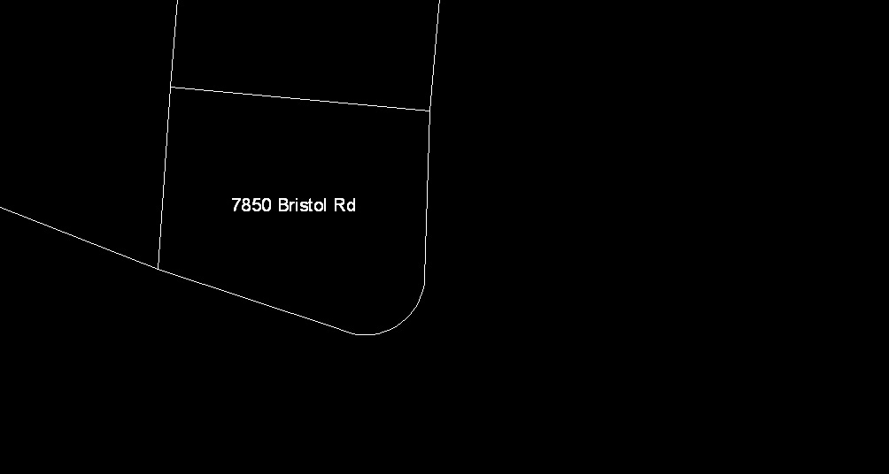
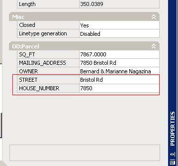
Now in the value textbox in the Annotation Text dialog box I use the strcat function like so. (strcat :HOUSE_NUMBER@Parcel " " :STREET@Parcel). What this does is takes the house number value and the street value from the parcel table and joins them together on one line in my labels. Notice the double quotes with a space between them. This is to add a space between the number and street.


The result after using this is shown below. There are a few others expression evaluators that you can use from doing simple math to converting numbers to strings. Take a look under the topic Expression Evaluators in the Map help file.

Monday, April 17, 2006

Map R2007

Ok the new version is out and has been for a few days. However don't expect to see any tips or "how do" just yet from me here. It will be a while before I can get a copy of the final release. I do have a beta copy but it's a beta and not everything was functional in that version.
If you are a member of AUGI and want to sign up for a map course I may be teaching one for the July ATP session. It will cover importing shape files, labeling and a few alter property queries. You can't sign up yet but I'll keep everyone posted when it opens for enrollment. If you're not a member sign up it's free and a great source of info.

Monday, April 03, 2006

File Names and Paths

Having trouble importing files into MAP? Check the file name and the path to those files. Map import tools does not handle long file names, file names with spaces or some of the standard characters that other times may work. The civil points import command is really picky at times when it comes to the file name. So if you have trouble creating points from “Section 2 Bubba Subdivision Contour Survey Points.mdb try to rename the file to something like B2CP.mdb.
The shape file import tools doesn’t like long paths to the shape files, so if the files you want to import are in “Z:\GIS\CityData\2006\March\Share\Parcels\Data\Polygons” try making a copy of the needed files in a folder on your local drive “C:\Import”. After the imports are done you can go back and clean up that folder by deleting the shape files.