Step one import the shape file and map the data from the file to an Object Data table.
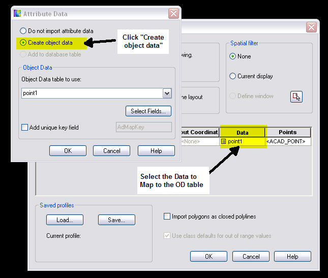
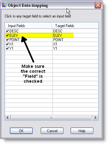
Make sure you check the correct data fields that contains the “Z coordinates” (Elev in this example).
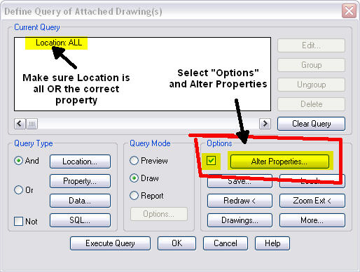
Once the points are imported save and close the drawing. Open a new drawing or your project that you need the points in, attach the drawing you just created. Create an alter-properties query, in this sample I am using “Location ALL” because there is only the points in the drawing. If you already have the points with the OD in an existing drawing you can filter just the layer, points or what you need by the standard query methods.
Select the option for “Alter properties”
From the Set Property Alterations dialog select Elevations and click on the Expression button.

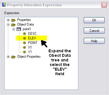
In the Property Alteration Expression dialog expand the Object Data tree and select the field that contains the Z coordinate value. This example uses a field called ELEV.
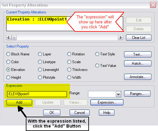
Press OK and it takes you back to the Set Property Alterations dialog. Click on the “Add” button to add the expression to the list.
Click OK in dialog and run the query using the Draw Mode. After the query is ran you can click on a point and verify the new Z coordinate position matches the value from the OD table.

This method of using an Alter Properties Query can also be used to set the elevations for blocks if the value is stored as attributes. For the expression use the properties of the block attribute and get the value from there.
3 comments:
This is great information.
can this method can also be use to import imformation on a given object(s)i.e. coordinates locations from gis tables.
I did bring the tables in trough work space all i get is this information on tables. Is it possible to attach this info to my object? links? do you know the proccess
Thanks,
Guillermo
Am I ever glad I found this. I could not find a way to get z values on my contours from this .shp file, but your method worked perfectly. Thanks.
Am I ever glad I found this. I could not find a way to get z values on my contours from this .shp file, but your method worked perfectly. Thanks.
Post a Comment